
Altitude Map
Explore how high people live and climb. The map plots well-known cities, summits and low points by elevation, coloured from sea level to the highest peaks. Tap “Use my location” to see the altitude your device’s GPS reports, or enter any altitude to see the air pressure, effective oxygen and boiling point of water up there.
- Free to use
- No sign-up
- Runs in your browser
Altitude map and calculator
| Place | Elevation | Type |
|---|
High-Altitude Travel & Activity Planner
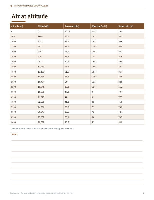
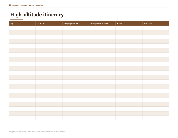
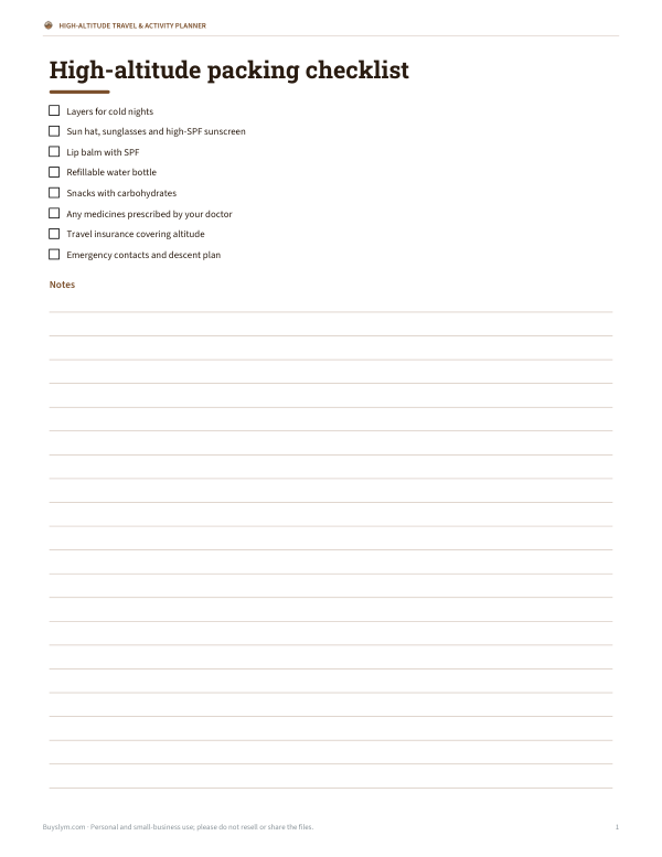
Printable altitude reference chart (pressure, oxygen, boiling point), an acclimatisation itinerary planner, a high-altitude packing checklist and a hike elevation log.
- Altitude reference chart (PDF, XLSX)
- Acclimatisation planner (PDF, DOCX, XLSX)
- Packing checklist (PDF, DOCX)
- Hike elevation log (PDF, XLSX)
Formats: PDF, XLSX, DOCX. Instant download after payment (link valid 72 hours, up to 5 downloads). AI-assisted: the templates were drafted with AI help and reviewed and laid out before publishing.
$4.00 USD, one-time 4 files · about $1.00 each
- Instant download
- 7-day refund
- Secure checkout by Stripe
7-day money-back guarantee. Full refund within 7 days of purchase, even after you download.
Free sample: Acclimatisation Planner (PDF, 55 KB)
Full refund within 7 days — see the refund policy and license.
Free printables
Single sheets you can print right now, no sign-up. The full pack adds every sheet in one download plus the editable files.
 Printable Hike Elevation Log
What the altitude map shows
The map plots more than fifty well-known places — high-altitude capitals and cities, the summits of famous mountains and two of the lowest points on land — at their latitude and longitude, coloured by elevation above sea level. It is a quick way to see where people live high up: along the Andes, in the Ethiopian and East African highlands, on the Tibetan Plateau and in the American Rocky Mountain states. Elevations are approximate, rounded published figures; cities span a range of heights, so the figure is typical of the centre.
Highest capital cities and cities
| Place | Approx. elevation |
|---|---|
| La Paz, Bolivia (seat of government) | 3,640 m (11,940 ft) |
| Quito, Ecuador | 2,850 m (9,350 ft) |
| Thimphu, Bhutan | 2,334 m (7,660 ft) |
| Bogotá, Colombia | 2,640 m (8,660 ft) |
| Addis Ababa, Ethiopia | 2,355 m (7,730 ft) |
| Mexico City, Mexico | 2,240 m (7,350 ft) |
| Denver, USA (“Mile High City”) | 1,609 m (5,280 ft) |
How your device measures altitude
- GPS — phones and watches with GPS can report altitude, but vertical accuracy is typically worse than horizontal, often ±10–30 m or more.
- Barometric sensors — many phones and watches have a barometer, which tracks changes in height well but drifts with the weather unless calibrated.
- Laptops and desktops usually estimate location from Wi-Fi and do not report altitude at all.
- Maps and elevation models — mapping apps look up ground elevation from digital elevation models, often the most reliable number for where you stand.
The “Use my location” button shows whatever altitude your browser provides, with its reported accuracy. Nothing is sent anywhere — the calculation happens on your device.
Air at altitude
| Altitude | Air pressure | Effective oxygen | Water boils at |
|---|---|---|---|
| Sea level | 101 kPa (100%) | 20.9% | 100 °C (212 °F) |
| 1,500 m (4,900 ft) | 85 kPa (84%) | 17.5% | ≈95 °C (203 °F) |
| 2,500 m (8,200 ft) | 75 kPa (74%) | 15.5% | ≈92 °C (197 °F) |
| 3,500 m (11,500 ft) | 66 kPa (65%) | 13.6% | ≈88 °C (191 °F) |
| 5,000 m (16,400 ft) | 54 kPa (53%) | 11.1% | ≈83 °C (181 °F) |
| 8,849 m (Everest) | ≈31 kPa (31%) | ≈6.5% | ≈70 °C (158 °F) |
Values use the International Standard Atmosphere. The air is still 20.9% oxygen at altitude, but lower pressure means fewer oxygen molecules per breath; the “effective oxygen” figure expresses that as a sea-level equivalent. Real pressure varies with weather and temperature.
Altitude and your body
Above about 2,500 m (8,000 ft), many people notice altitude effects such as breathlessness, headache, poor sleep and reduced appetite. Acute mountain sickness is common in visitors who ascend quickly. General mountain-medicine advice is to ascend gradually, rest on arrival, stay hydrated, avoid alcohol for the first days, and descend if symptoms worsen. Severe symptoms — confusion, loss of coordination, breathlessness at rest — are an emergency. People with heart or lung conditions, and anyone planning high-altitude travel, should talk to a doctor beforehand.
Cooking and baking at altitude
Because water boils at a lower temperature, foods cooked in water — pasta, rice, beans, eggs — take longer at altitude. In Denver water boils at about 95 °C (203 °F); in La Paz at about 88 °C (190 °F). Baking recipes often need adjustments above about 900 m (3,000 ft): less leavening, slightly more liquid, a hotter oven and shorter baking times. Pressure cookers restore higher cooking temperatures and are popular in high cities.
Worked example
Planning a trip from sea level to Cusco (about 3,400 m), a traveller enters 3,400 in the calculator. Air pressure is about 67 kPa — two-thirds of sea level — so each breath contains roughly the oxygen of 13.8% at sea level, and water boils at about 89 °C. They plan a lighter first day, extra fluids and a gradual itinerary, and check the Sacred Valley (lower, around 2,900 m) as a place to acclimatise first.
Measuring elevation: sea level and datums
Elevation is measured above a reference surface, usually mean sea level approximated by a geoid model. GPS measures height above a mathematical ellipsoid, which can differ from sea level by tens of metres depending on location; devices apply a correction to show height above sea level. That is one reason different apps can show slightly different altitudes for the same spot.
Privacy
The map and calculators run in your browser. If you use “Use my location”, your browser asks permission and the position stays on your device — it is not uploaded or stored.
Frequently asked questions
How do I find my current altitude?
Tap “Use my location”. Phones with GPS usually report altitude; laptops often do not.
What is the highest capital city?
La Paz, Bolivia’s seat of government, at about 3,640 m. Quito is the highest official capital at about 2,850 m.
At what altitude does altitude sickness start?
Symptoms are common above about 2,500 m (8,000 ft), especially after rapid ascent.
Why does water boil at a lower temperature at altitude?
Lower air pressure lets water turn to vapour at a lower temperature.
How accurate is GPS altitude?
Often within 10–30 m, but it varies; barometric sensors track changes more precisely.
Is my location uploaded?
No. It is used only on your device.
Why is the Dead Sea shown below zero?
Its shore is about 430 m below sea level, the lowest land surface on Earth.